August 27, 2021
I hiked at the top of Albuquerque on Friday.
I wanted to take a shorter and easier hike this weekend but still wanted to accomplish something. I decided, instead of going for distance, time or elevation gain, to go for my highest hike on the North Sandia Peak Trail.
Trail Stats
AllTrails has this trail rated as an easy 3.7 mile trail with 705 feet of elevation gain.
The trailhead is just off the parking lot at the Sandia crest where the elevation is 10,644 feet. I’d started from this location before, on my hike down the South Crest Trail and La Luz Loop, but that hike dipped me down to just under 10,100 feet. I wanted to stay elevated on this hike.
So It Begins
I stopped at Starbucks, as has become my normal routine, and for a Blake’s breakfast burrito before heading up my normal route, up Central to Old Route 66, to highway 14, through Cedar Crest and up to the Sandia Crest Scenic Byway to the top.
Sandia Crest is the highest point on the mountain. The trail leaves the parking lot at the crest and largely follows the North Sandia Crest Trail (trail 130).
I set off, walking past the chain link fences enclosing the radio towers on top of the mountain. There was a humming sound as I walked past the towers and what I presume is a power station providing electricity to them, as well as the Crest House.
After about a quarter mile, the fence ended and I was plunged into the Sandia Wilderness.
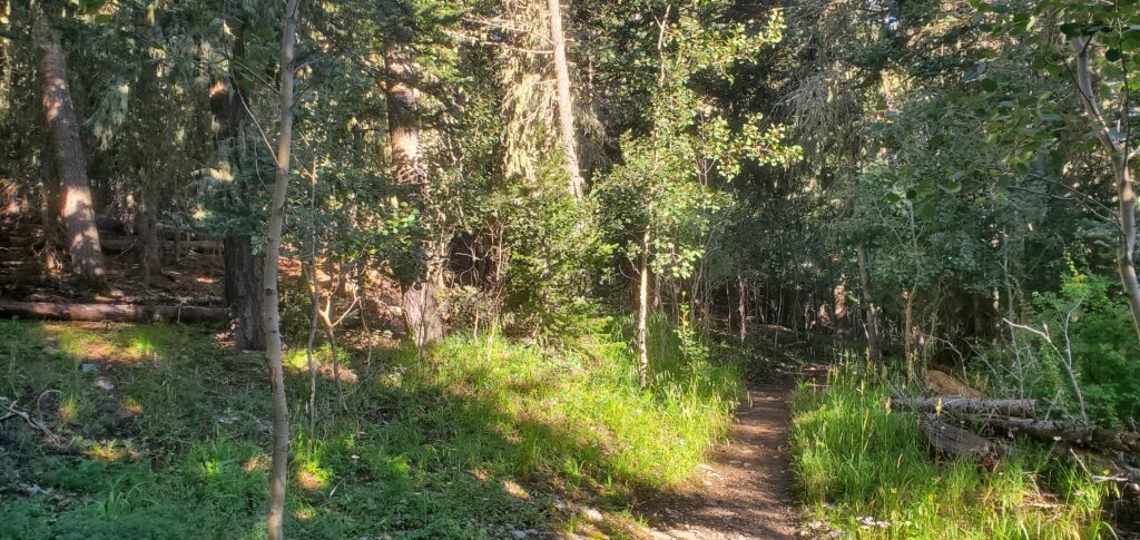
Surrounded by the familiar trees and shrubs, I hiked along the trail as it steadily, but gradually, descended from the high point of the mountain. The path was mostly dirt with some exposed roots to contend with, and very little rock, at least for the first mile or so of the hike. Soon, the dirt saw more and more rocks poking through.
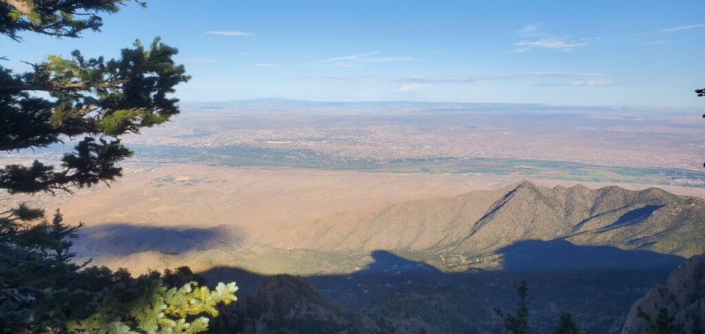
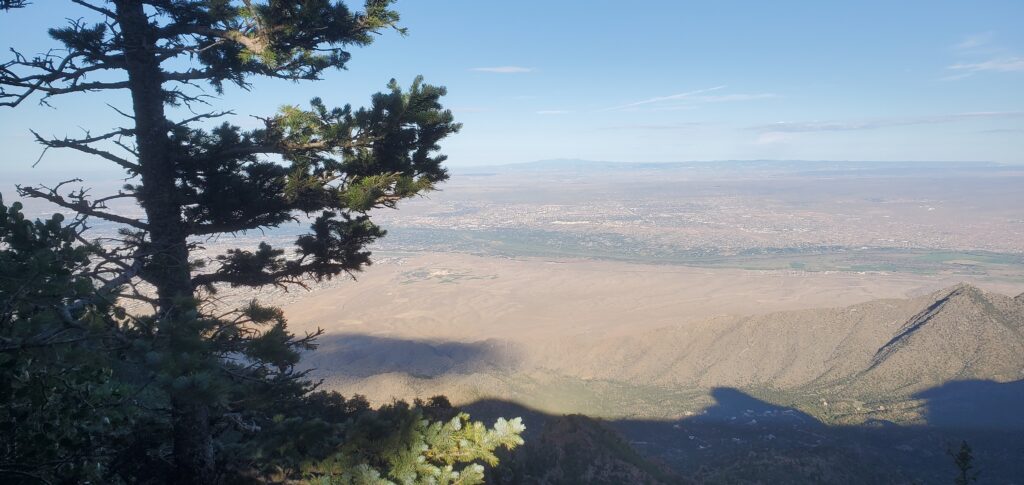
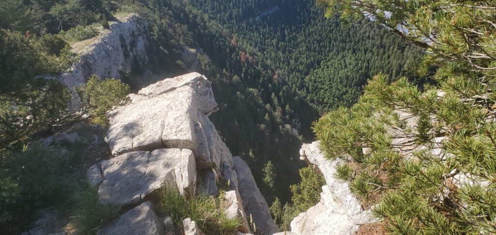
I came across a couple of overlooks that peered down on the city of Albuquerque. From a little further north than the overlook at the crest, it seemed to provide a different perspective of the city, even though I was barely a mile north of the usual overlook.
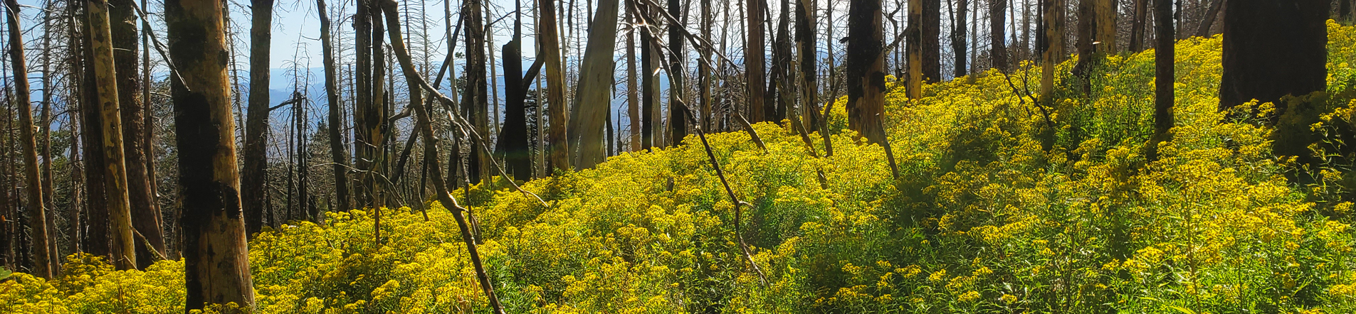
The Wildflowers!
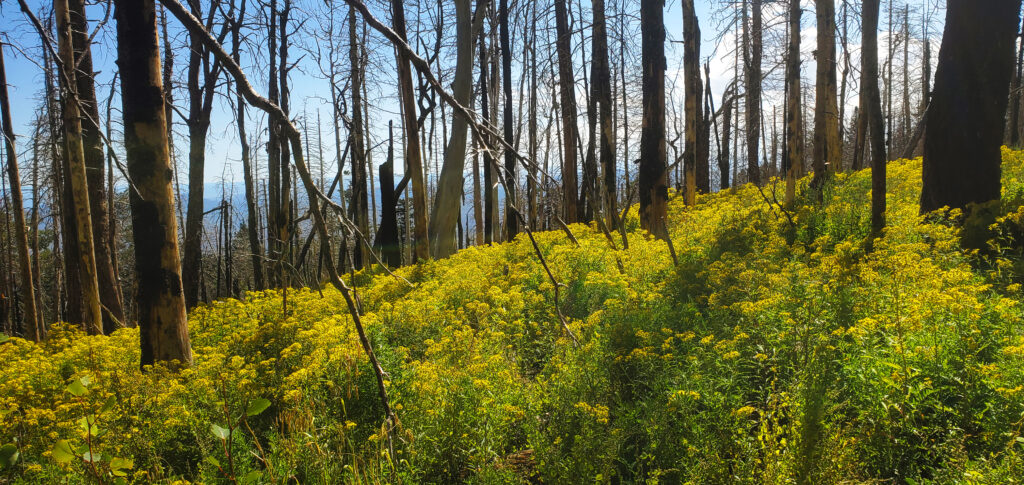
There are plenty of areas where I exited the forest and found myself in a meadow ablaze in the colors of wildflowers. I was most astounded though when I happened upon a very large meadow with a field of what appeared to be yellow daisies (#NotABotanist) that had grown to about the height of my waist.
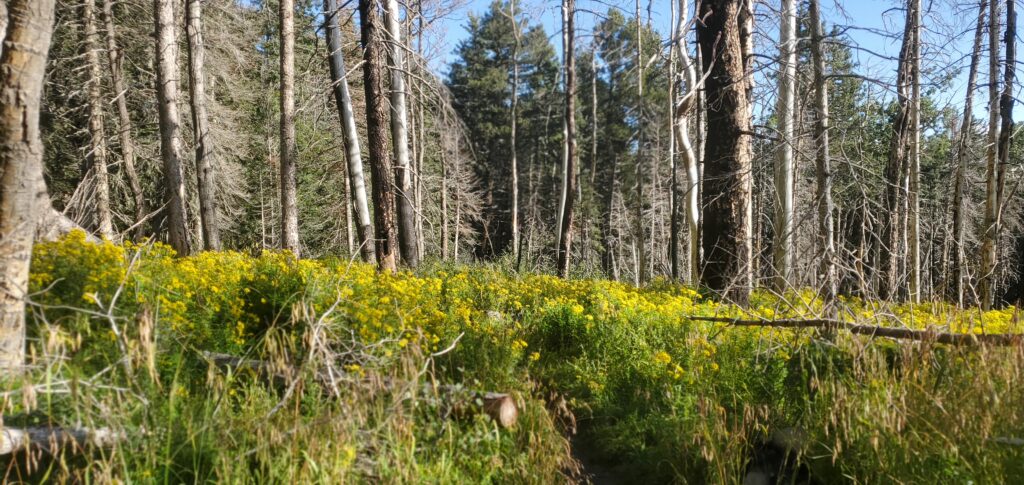
The field stretched out so incredibly far. I was awestruck by just how beautiful it was.
At about 1.7 miles, the North Crest Trail continues on to the Del Agua overlook that I has recently passed by on my trip on the 10K and Survey Loop. Instead of following that though, I broke to the left on the Crest Spur trail. From this point, the trail took a dramatic turn upward, seeing grades in the double digits pretty much the rest of the way to the top.
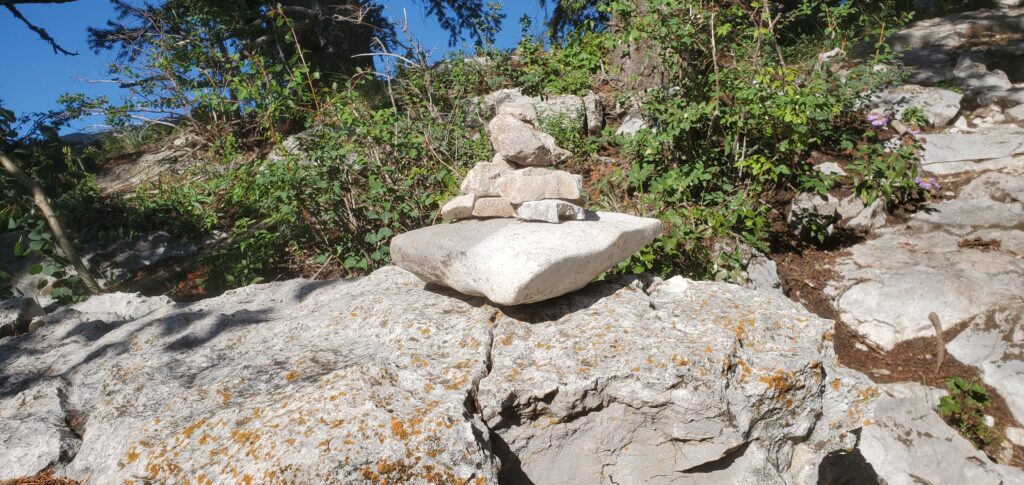
Shortly after splitting off onto the spur trail, the path kind of disappears. I wandered around for a bit trying to find my way back onto the trail, eventually finding my way back on.
I guess I should have followed the cairn.
I continued upward and onward, finally reaching my destination, the North Sandia Peak, situated at just over 10,400 feet above sea level.
There was a small, flat area that was pretty well surrounded by trees, and upon which sat a couple of 3 foot by 3 foot square concrete foundations that apparently held a signal beacon used during World War II. I wandered around for a bit and marveled at the view.
At this point, I’m absolutely mortified to report that I did not take any pictures from the top of Sandia Peak.
I did, however, record some video.
The Return
Once I ate my burrito, I packed up and began the return trip.
The steep incline I had just climbed to get to the peak was now a steep descent back to the North Crest Trail. I wound up using my trekking poles kind of as “brakes” to slow my descent, and even found myself side-stepping down the hill at times to help prevent my feet jamming into the toes of my boots.
Once I reached the North Crest Trail, it was a slow but steady climb back up about 200 feet over about a mile and a half. It was a good mix of double digit uphill grades and level ground but it still took me a lot longer to get back up the trail than I had hoped. I blame the elevation. Spending most of my days at right around 5,300 feet, then suddenly climbing to well over 10,000 feet certainly makes a difference in the amount of oxygen that’s available. In fact, I just read that there is 12% less oxygen at 10,000 feet than there is at 5,000 feet.
So yeah, I got winded.
I finally made it back to my car in the parking lot at the crest about 3 hours after leaving. This with a half hour break at the peak giving me about a 2.5 hour moving time on the trail, to cover 3.7 miles, at that altitude. I’m pretty pleased with that performance.
Conclusion
Hiking at the highest point in Albuquerque was definitely an experience. I am eager to try my hand at Wheeler Peak the highest point in New Mexico. That sits at about 2,500 feet higher than the high point in the Sandias. That’s gonna take some training.
In the meantime, I’ll keep stretching out my distances and times, and even will try my hand at crossing Sandia Mountain via the Crest Trail, hiking from Placitas to Cedar Crest (which at over 25 miles would be a 2 day trip.)
But first, a camping trip!
Until then, though, here are a couple more pictures from my hike, and as always, thank you for stopping by! I appreciate you!
-Phil
Pingback: Cedro Creek Nature Trail 5 – Wandering New Mexican