June 26, 2021
While camping in Carson National Forest, I decided to take a hike into the Columbine-Hondo Wilderness on the Columbine Trail. Read on for the full experience.
Trail Stats
The Columbine Trailhead is located within the Columbine Campground and largely parallels the Columbine Creek south into the Columbine-Hondo Wilderness of the Carson National Forest.
AllTrails lists this trail as a moderate 8.5 mile trail with a 1,935 foot elevation gain. Spoiler alert: we did not finish this trail.
Departure
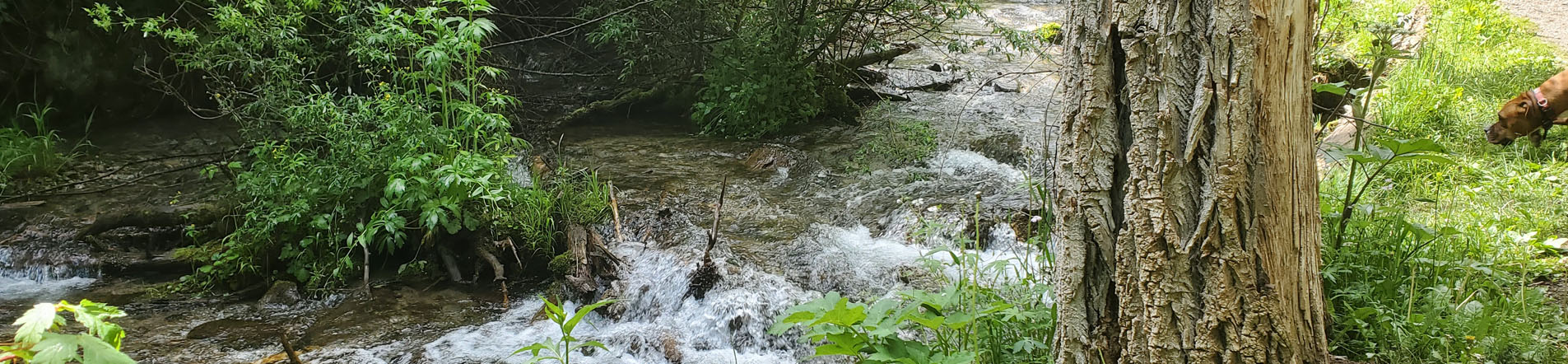
Alan and I began our trek at around 9:15 am, trying to get a head start before the impending rain that was expected later in the day. We started off at a moderate clip on a fairly wide trail, surrounded on both sides by huge pine and aspen trees, and followed by the sound of the babbling creek running next to the trail. Before long, we came across a deer leg that had been pretty well picked over leaving cleanly exposed bones. Leftovers from a mountain lion, Alan suspected.
We continued on as the trail narrowed and started a more significant incline. We went up some hills that seemed steeper than they evidently were. AllTrails tells me I maxed out at a 12% incline at the steepest. Sure seemed steeper…
We soon came across a narrow foot bridge that carried the path across the creek. Having already scouted the path the day before, Ash knew what to do so he ran across with ease. Alan and I followed closely behind.
As we traveled along, I soon developed a cramp in my foot. After a doctor visit just three days prior, it turns out I likely have an electrolyte deficiency. I had bought a couple of Powerades to take on the hike with me, but forgot them at camp. Luckily, Alan had the foresight to make sure we brought salty snacks (trail mix) so I munched on some of that until the pain subsided.
We carried on, not encountering a ton of people, but enough to know we weren’t alone on the trail. The trail progressively narrowed and ultimately became a single-wide path through a narrow notch through the mountains. We were surrounded by a lush aspen forest on one side and a sheer rock cliff on the other. The Columbine Creek continued to run on through a deep ravine between the path and the rock face. If we ventured off the trail enough, we’d be able to peer down into the crevasse to see the moving water.
We ventured onward and upward. I was astounded by the size of the golden cliff walls that towered into the sky above us. I saw some similar cliffs as we drove into the camp, but walking through the wilderness being enveloped this way was a whole new perspective.
We crossed the creek twice more on bridges like the one we’d already crossed before reaching what would ultimately be our apex. We turned a bend and were greeted by a vast, grassy meadow. Ash, not being on his leash, took off to frolic in the open expanse while Alan and I watched from the path.
By that point, according to AllTrails, we had accumulated over 2,000 feet of elevation gain throughout the hike, and that was over the course of just over a mile and a half. By that time, the sky was becoming increasingly overcast, the threat of rain growing by the minute. I could smell the petrichor on the breeze and the air cooled as we were plunged into light shadows. We decided it was time to turn back.
The Descent
By logic, the return trip should have been nearly all downhill however I noted part way through that it seemed like we were still climbing. It wasn’t a strenuous return trip by any means, so we made it back in a pretty reasonable time.
As we returned to the campground, we saw a large group of people of Asian descent congregating in the parking lot at the trailhead. We watched as the group swelled to about 30 or 40 people, then they all took off into the wilderness from where we had just returned.
Conclusion
All told, I set personal bests in distance, elevation gain and time on trail with this hike. The scenery was magnificent and awe-inspiring, and I would like to be able to hike the entire trail and its eight an a half mile, 1,935 foot elevation gain.
For now though, a little over a third of the trail will have to do.
The pictures I took on this hike are mixed in with the pictures from my camping trip over the weekend of June 25-27 in my Photo Diary. Check them out, and stay tuned for a wild adventure that Ash and I went through on our Fourth of July hike.
As always, thanks for stopping by! I appreciate you!
-Phil
Pingback: Camping: Columbine Campground, Carson National Forest – Wandering New Mexican