April 17, 2021
Just when we thought we were getting into nice, warm Spring weather, I decided to hike on the traditional Albuquerque Spring Snow Day.
Every year, not long after the weather here in Albuquerque starts warming up, we have one last day where we see winter type weather and, quite often, snow. Turns out, today was that day. And today is the day I decided to head up into the mountains for a hike.
I decided to take the hike Brandy and I tried to do last weekend, the Sulphur and Cienega Horse Bypass Loop trail. Brandy tapped out early on as it was a fairly steep approach to the trail and she wasn’t in the mood for it.
So early this morning, I got dressed in jeans and a t-shirt with my wool socks and hiking boots. I took my sweater because I knew it was supposed to be cold. I filled my backpack with the usual stuff: water for me, a separate bottle for Ash, his bowls and a baggie of food for him. We headed out at about 8:45, stopping at Starbucks on the way for a coffee and a pup cup.

It was super cold and windy on the drive up to Cedar Crest but I did notice on the way up that Tinkertown is open! Yay! I love Tinkertown, and missed going last year.
Anyway, I parked at the Sulphur Canyon Picnic Area at about 9:45, strapped on the backpack and headed up the trail, dog in tow. AllTrails has the trail listed as an easy 2.2 mile loop trail with a 433 foot elevation gain.
The first part of the trail is a paved road but the pavement eventually ends and you’re left hiking on dirt. As you’ll see on the elevation profile at the end of the post, the trail is an incline almost all the way to the midpoint. I eventually got to the end of the Sulphur Canyon Trail where it ends at the Faulty Trail. I didn’t have a signal so I couldn’t pull up the map to see which way I was supposed to go (I NEED to subscribe to AllTrails Pro) so I trusted my instinct and turned left.
We meandered through Cibola National Forest on the Faulty Trail for a short bit before coming to the intersection with Cienega Horse Bypass Trail. The dirt trail eventually became littered with loose rock which became hazardous when I twisted my right ankle… three separate times. With Ash very full of energy, he was pulling hard on the leash making the hike even more treacherous.
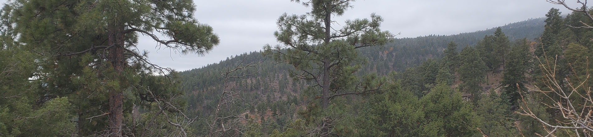
Peaking at over 7,600 feet, we were surrounded by some fantastic vistas of forest in every direction. The day was grey and cold with snow flurries from time to time as we walked. The low clouds hung just below the treetops at times giving the views an even more ethereal feel. It was quiet with only the sound of wind rustling through the leaves and birds calling from all parts of the forest.
The trail finally emptied out onto a road that leads to a horse trailer parking lot. We walked down a hill finding ourselves in the parking lot for the picnic area where we started. We stopped at a picnic table so I could give Ash some water before we headed back up another incline to the car where my car told us it was 28 degrees.

By the time all was said and done, we finished the trail in about an hour and a half, and set a new personal best in elevation gain. It was tough goings at times, having to stop to catch my breath from time to time on my way up, and after twisting my ankle numerous times, but I’ve never felt better.
I’ll be posting my plans for tomorrow here in a little bit. Stay tuned for that at some point today.
In the meantime, here are some photos from today’s journey.
-Phil


Pingback: Planned Trip: Tinkertown, Burger Boy and (Maybe) a Hike to Sandia Peak – wanderful